ISRO's Bhuvan portal to be more powerful, efficient than Google Earth
05 Nov 2008
 Gandhinagar: The Indian Space Research Organisation (ISRO) will launch an IRS (Indian Remote Sensing) image portal called Bhuvan and an information portal called Bhu Sampada by March 2009. According to ISRO chairman, G Madhavan Nair, the Bhuvan portal is expected to be more powerful and efficient than the popular Google Earth.
Nair made the announcement while delivering the Todar Mal Lecture on ''Benefits of Space to the Society,'' organised at the inaugural function of the Indian National Cartographic Association (INCA) Congress in Gandhinagar on Tuesday.
Nair said that upon being integrated with application-specific Spatial Decision Support (SDS) tools, these two unique portals would open up a new era of collaborative mapping in the country. ''These are not mere image or information browsers, but are the mechanisms for providing satellite images and thematic maps to the user community for the purpose of development planning,'' he said.
He added that the ''present day requirement as well as the trend of meeting multiple information demands at different levels of details, dynamically, and with specific analysis and synthesis capabilities, has prompted ISRO to launch these two portals.''
Since the late 1960s, India has achieved enhanced agricultural produce through intensive irrigation, genetically improved crops, use of inorganic fertilisers and chemical pesticides. But, this has also unfortunately led to water logging and salinity in irrigated areas resulting into depleted irrigation efficiency.
''In this context, remote sensing based studies using IRS data has been carried out to arrive at solutions for enhancing the water use and reclamation of degraded lands,'' Nair said. He also called for scientific means to manage the natural resources and environment for the future generations, adding that increasing soil erosion is a major concern.
Annually, dwindling groundwater potential, lack of infrastructure, both physical and social, and increased frequency of disasters, are also matters of concern, he said. Therefore, there is an urgent need to reverse the effect of degradation with proper use of appropriate technology, he added.
As many as 400 delegates from India, the US, Australia and Germany will deliberate over Satellite Image Technology and Collaborative Mapping for the next three days at an annual affair of the Indian National Cartographic Association (INCA).
This year it is being hosted by ISRO's Ahmedabad–based Space Applications Centre (SAC).
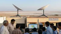
Nair also elaborated on the role played by space technology in societal development. ''The use of satellites in communications, in remote sensing, in GIS, in tele-education and in tele-medicine should not be underestimated. EDUSAT has created more than 30,000 virtual classrooms while about 300,000 patients have been benefited by use of tele-medicine. About 450 Village Resource Centres in 22 states have also become operational,'' he said.
Nair also enumerated on the role played by space technology in forecasting crop production, in urban morphology, in remote sensing of gases, in identifying the potential fisheries zone and prospective ground water, in watershed development and in wasteland mapping.