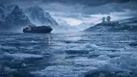
Study projects sea levels may rise 8ft by 2100
14 Dec 2017
Many of us might experience more than double the amount of sea level rise projected earlier, unless we sharply curtail greenhouse gas emissions, according to a new study that factors in emerging, unsettling research on the tenuous stability of the Antarctic Ice Sheet.
The new study projects a median sea level rise of 4 feet and 9 inches during the 21st Century if greenhouse gas emissions remain on their current high trajectory.
Expressed as a range, the study finds that a high emissions scenario that takes new Antarctic melt mechanisms into account would yield between 3 and 8 feet of global average sea level rise by the year 2100.
The study also highlights that we could still make cuts to greenhouse gas emissions during the next several years that would significantly reduce the possibility of a sea level rise calamity after 2050.
The study was published yesterday in the open access journal Earth's Future and is the first to attempt to factor in mechanisms that would lead to the sudden collapse of parts of the Antarctic Ice Sheet, such as the disintegration of floating ice shelves and mechanical failure of tall ice cliffs facing the sea. The study also goes further showing how the new projections could apply to cities across the world.
Researchers from a number of institutions, including Rutgers University, Princeton, Harvard, and the nonprofit research group Climate Central found that sea level rise projections that factor in faster, even sudden disintegration of huge parts of the Antarctic Ice Sheet would yield far more dire projections.
This becomes clear when compared to the consensus put forward by the UN Intergovernmental Panel on Climate Change (IPCC) in 2014.
The IPCC did not consider the possibility that the Antarctic Ice Sheet could become unstable as air and sea temperatures warm, and essentially crumble into the sea, in rapid succession.
Meanwhile, glaciologists would soon have a treasure trove of data for exploring how Antarctica's underbelly has changed over nearly half a century, thanks to the efforts of an international team of researchers. The researchers scanned and digitised 2 million records from pioneering aeroplane radar expeditions that criss-crossed the frozen continent in the 1960s and 1970s.
''These are the flights that invented this way of doing glaciology,'' says Dustin Schroeder, a radar engineer at Stanford University in California who is leading the new project, Nature reported.