Isro’s PSLV-C38 all set to launch Cartosat and 30 nano satellites
22 Jun 2017
The Indian Space Research Organisation (Isro) is all set to launch its Cartosat-2 series `eye in the sky' satellite for earth observation along with 30 co-passenger satellites.
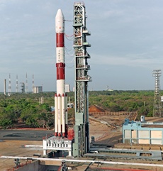 Isro's workhorse, the Polar Satellite Launch Vehicle (PSLV), in its 40th flight (PSLV-C38), will carry these satellites into orbit. The rocket is scheduled to take off from the Sriharikota space port near Chennai at 9.29 am on Friday, an Isro release said.
Cartosat-2 Series Satellite is the primary satellite being carried by PSLV-C38. This remote sensing satellite is similar in configuration to earlier satellites in the series with the objective of providing high-resolution scene specific spot imagery.
The 712-kg Cartosat-2 Series Satellite along with 29 co-passenger satellites from abroad and one from India, together weighing about 243 Kg at lift-off' is planned to be launched into a nominal altitude of 505 km.
The primary Cartosat-2 series satellite is a remote sensing satellite. The imagery sent by the satellite will be useful for cartographic applications, urban and rural applications, coastal land use and regulation, utility management like road network monitoring, water distribution, creation of land use maps, change detection to bring out geographical and man-made features, and various other land information systems, as well as for geographical information system (GIS) applications.
The co-passenger satellites comprise 30 nano satellites, including one from India and 14 other countries - Austria, Belgium, Chile, Czech Republic, Finland, France, Germany, Italy, Japan, Latvia, Lithuania, Slovakia, United Kingdom, and the United States.
The total weight of all the satellites carried onboard PSLV-C38 is about 955 Kg.
This will be the seventeenth flight of the PSLV in its 'XL' configuration (with the use of solid strap-on motors).
India uses satellites for various purposes, including observation of land, water and ocean and for meteorological purposes and has accordingly named these as Resourcesat, Cartosat, Oceansat, RISAT, and INSAT series. It also envisages placing a geo-imaging satellite in geostationary orbit to enable near real-time imaging.
The overall aim is to maintain the continuity of services and carry out enhancements in technological capabilities with respect to sensors and payloads to meet operational applications. Isro plans to design, develop and launch Cartosat-3 and Oceansat-3. In the future, Isro will also launch more satellites from the INSAT series for meteorological applications.
Cartosat-1, the first in the series of earth observation satellites, was launched on 5 May 2005, using the PSLV-C6 launch vehicle, followed by Cartosat-2 on 10 January 2007.