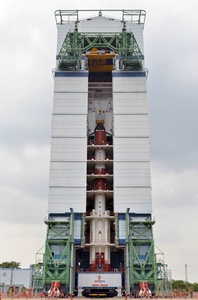
ISRO successfully launches India’s third navigational satellite IRNSS-1C
16 Oct 2014
India today successfully launched IRNSS-1C, the third navigational satellite in the Indian Regional Navigation Satellite System (IRNSS), moving a step closer to setting up the country's own navigation system on par with Global Positioning System (GPS) of the US.
 ISRO's Polar Satellite Launch Vehicle, PSLV-C26, launched the IRNSS-1C in the early hours of today (0132 hours IST) from the Satish Dhawan Space Centre, Sriharikota in Andhra Pradesh.
"India has successfully launched IRNSS 1C. The entire ISRO team deserves congratulations," ISRO chairman K Radhakrishnan said after the launch.
He also thanked the entire team that worked behind for the successful launch.
This was the seventh time ISRO was using an XL version of the PSLV rocket for its missions and the 27th consecutively successful PSLV mission.
The 'XL' configuration of PSLV was used for this mission. Previously, the same configuration of the vehicle was successfully used six times.
The lift-off and separation of the satellite took place as planned. After a flight of about 20 minutes 18 seconds, IRNSS-1C Satellite, weighing 1,425 kg, was injected to an elliptical orbit of 282.56 km X 20,670 km, which is very close to the intended orbit, ISRO said in a release.
After injection, the solar panels of IRNSS-1C were deployed automatically. ISRO's Master Control Facility (at Hassan, Karnataka) assumed the control of the satellite. ISRO will carry out four orbit manoeuvres from MCF to position the satellite in the geostationary orbit at 83 deg East longitude.
IRNSS-1C is the third of the seven satellites constituting the space segment of the Indian Regional Navigation Satellite System. IRNSS-1A and IRNSS-1B, the first two satellites of the constellation, were successfully launched by PSLV on 2 July 2013 and 4 April 2014 respectively.
"Both IRNSS-1A and 1B are functioning satisfactorily from their designated geosynchronous orbital positions," ISRO said.
IRNSS is an independent regional navigation satellite system designed to provide position information in the Indian region and 1,500 km around the Indian mainland. IRNSS would provide two types of services, namely, standard positioning services (SPS) - provided to all users - and restricted services (RS), provided to authorised users.
The mission life of the 1,425,4 kg is 10 years. The launch of PSLV 26 carrying IRNSS 1C was actually scheduled on October 16 but the countdown was postponed following technical reasons. The fully deployed IRNSS system would consist of three satellites in GEO stationary orbit and four in inclined geosynchronous orbit, about 36,000 km altitude above earth.
A number of ground stations responsible for the generation and transmission of navigation parameters, satellite control, satellite ranging and monitoring, etc., have been established in as many as 15 locations across the country.
In the coming months, the next satellite of this constellation, namely, IRNSS-1D, is scheduled to be launched by PSLV. The entire IRNSS constellation of seven satellites is planned to be completed by 2015.


