Cartosat 2A to be India's first dedicated military satellite; launch set for August
11 Jun 2007
The Cartosat 2A will be a military version of the Cartosat 2 satellite launched by ISRO in January this year.
According to reports, the Cartosat 2A will carry an advanced synthetic aperture radar (SAR) made by Israel and a digital camera with a resolution of less than one metre. The Cartosat 2A will give India the capability to monitor missile launches by rivals Pakistan and China, and also make the country only the second Asian country after Japan to have this advanced capability.
The Cartosat-2A is officially billed as a reconnaissance satellite, but will cater exclusively to military and intelligence needs, and will have more advanced capabilities than any existing Indian satellite, according to government sources.
The satellite will be the first of a series of three advanced imaging satellites - the other two are slated for launch in 2008 - that will give India a sustained capability to reconnoiter the entire region.
The constellation of three satellites will also study the oceans and monitor changes in winds across the seas.
Cartosat 2A
The digital cameras on board Cartosat-2A will be far superior to those currently available with India's dual use, photo imagery satellites, such as the Resourcesat-1 and the Cartosat 1 & 2. Resourcesat-1 was launched in October 2003 and was considered to be India's most sophisticated remote sensing satellite.
The Cartosat-1 has two 2.5 metre, high-resolution cameras that are able to point at an object from two different angles, thereby creating a two dimensional image of a target object.
The other mapping satellite, Cartosat-2, launched in January 2007, has a one metre resolution camera and a 120 gigabyte storage capacity for captured images. The Cartosat-2 carries a state-of-the-art panchromatic camera that takes black and white pictures of the Earth in the visible region of the electromagnetic spectrum.
The swath covered by these high-resolution PAN cameras is 9.6 km and their spatial resolution is less than one meter. The satellite can be steered up to 45 degrees along as well as across the track.
Cartosat-2 is an advanced remote sensing satellite capable of providing scene-specific spot imagery. The data from the satellite will be used for detailed mapping and other cartographic applications, including urban and rural infrastructure development and management, as well as applications in land information systems and geographical information systems.
The successful launch of the Cartosat 2 allows India to compete with the US satellite Ikonos in producing high spatial resolution images.
The Cartosat 2 can produce images of up to 80 cm in resolution, compared to the one metre resolution offered by Ikonos. With Cartosat 2 offering better resolution, at twenty times lower cost per sqmt of imagery, Ikonos is faced with stiff competition from the ISRO.
Aerospace command
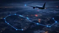
The launch of the Cartosat 2A has been timed to coincide with the scheduled delivery of the country's first airborne warning and control system (AWACS) aircraft by Israel. The induction of this system, along with the Cartosat 2A, along with the armed forces recent drive to equip themselves with a network-centric capability will now allow the Indian armed forces to carry out surveillance activities from the ground to the stratosphere.
The launch of the Cartosat 2A will also be in synch with the Indian Air Force's plans to set up an integrated air command, control and communication system that will link AWACS, aerostat balloon-borne radars and low-level transportable radars of the IAF with this dedicated military satellite.